About Ardailly
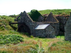
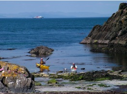
Ardailly is said to be the oldest settlement on Gigha. There are several derelict crofts, a corn mill and a cottage. It is at the end of a very muddy track. Above the shore is Dun an Trinnse - Fort of the Trench, a hill fort about 13m in diameter sitting above a small harbour with a stone jetty and with two large cup marked stones below it above a small sandy beach. Today the wee harbour of Port an Duin is home to gulls, cormorants, shags and sea otters.
gigha - the nearest and the fairest
-
WHERE IS GIGHA ?
-
It is on the west coast of Scotland, 3 miles west of the Kintyre Peninsula in Argyll. Northern Ireland is clearly visible to the south, with the skyline dominated by Islay and Jura to the west. Our ferry crews provide a good service for the twenty minute crossing which runs to a moreorless hourly timetable;
-
-
HOW BIG IS IT ? The island is about 6 miles long and a mile and a half wide at its widest and 100m at its narrowest. In area it is about 6 square miles. The highest point is only 100m above sea level. It has over 25 sandy beaches;
-
-
THE CLIMATE GIgha is warmed by the North Atlantic Drift and has a very mild, almost frost free climate. It is in a wee rainshadow so, though often wet and windy, has less rain and is less exposed than either Islay and Jura to the west and is drier and more fertile than Kintyre to the east. It is often dry and sunny when the mainland is cloudy and rainy. The seas are crystal clear aquamarine all year round.
-
-
WHO LIVES THERE ? It is home to about 160 people. There are over 20 kids in the primary school. Like any community, folk have their differences but Gigha has a justified reputation for being Scotland’s ‘Friendly Isle”
-
-
THE COMMUNITY Gigha was bought out from the then laird in 2002 and has been run by the community ever since. As an experiment in community ownership it revitalised the island, though the Trust is run on a private business rather than community development model. Successes have included the U.K.’s first community owned grid connected wind farm as well as a community Hotel. Local facilities are the shop/post office, the Gigha craft shop and Art gallery, a bistro at the Boathouse, a boat and cycle hire. The ‘big hoose’ is now privately owned but the community own 60 or so acres of surrounding Achamore Gardens which featuring a range of sub-tropicaI frost tender plants.


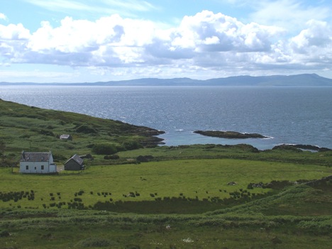
Looking from Creag Bhan, the highest point, west towards Ardailly and Islay beyond. Tigh Cruinn will be built on the hollow between Ardailly House in the foreground and the Mill in the background. With its turf roof it will be barely visible.
The roofless mill still has its wheel, said to have been brought in by sea. It milled oats. It was fed from the MIll and Upper Lochs above. the mill races are still there but the Mill Loch is now the reservoir for the island’s public water supply. Occasionally waste grains from the mill were tipped into the sheltered bay by the mill and seine nets set across the entrance. Saithe would come in shoals to feed from the grains and horses pull in the nets on to the shore. The fish landed were said to fill three trailer loads.
